GO
What GO means
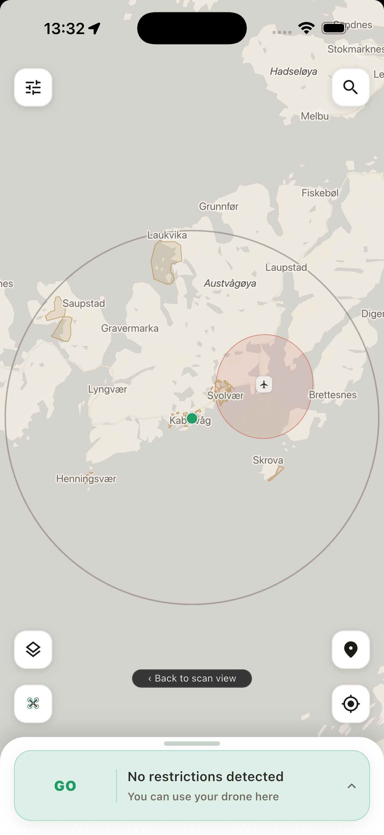
No mapped blocking condition was detected in the data available to this check. Local rules, permissions, temporary restrictions, weather and conditions at the site may still prevent a flight.
Drone safety for Norway
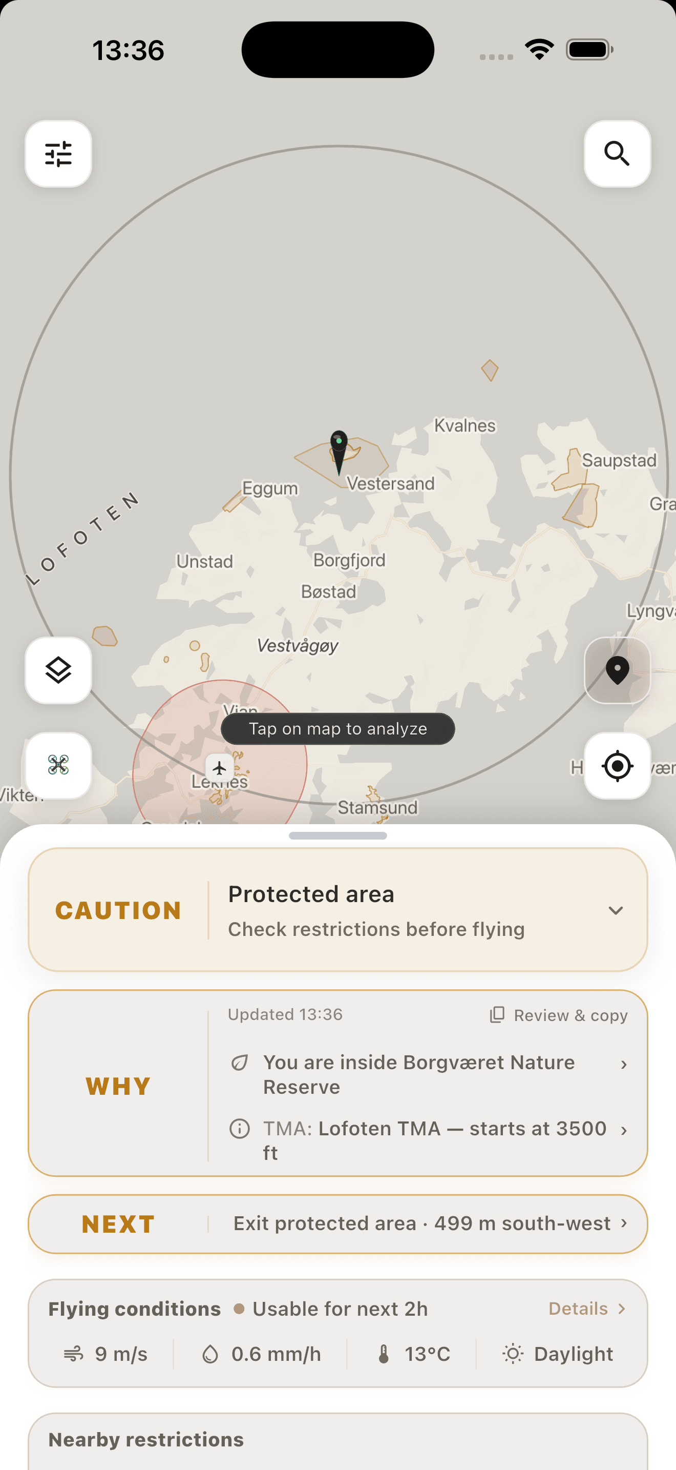
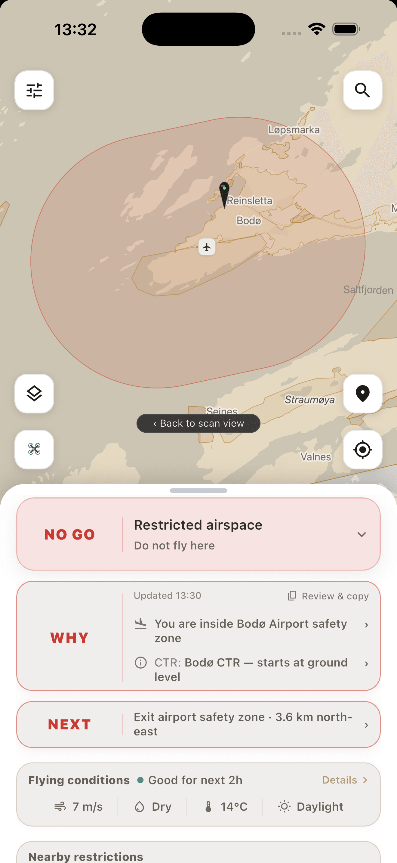
GoNoGo turns mapped airspace, airport and protected-area context around your current or planned location into one calm signal: GO, CAUTION or NO GO — with WHY and NEXT.
Guidance, not flight clearance. GoNoGo does not verify live NOTAM. Always complete an official pre-flight check before take-off.
See it in action
Understand why mapped context affects the result, what to do next and where the relevant boundary sits. A result never replaces the official pre-flight check.
How it works
GoNoGo is a Norway-first drone tool. It combines mapped context into guidance for the exact place you are checking.
Check your current position for free. Drone Pro adds Map Pin planning for a different location before you travel.
See airport zones, controlled and restricted airspace, protected areas and other relevant map layers within the selected radius.
Use WHY and NEXT to understand the guidance, then open the official services in the app and complete your own current pre-flight check.
Planning ahead? Map Pin is part of Drone Pro. Current-location checks and required safety layers remain free.
The iPhone app supports 8 interface languages.
A GO means only that GoNoGo did not find a mapped blocking condition in the data available to the check.
Safety contract
The app is designed to make uncertainty visible. It does not claim that a flight is legal, safe or permitted.
GO
No mapped blocking condition was detected in the data available to this check. Local rules, permissions, temporary restrictions, weather and conditions at the site may still prevent a flight.
NOTAM
GoNoGo does not currently ingest a live official NOTAM feed. The app therefore hands you over to official services for the current briefing.
Opening an official service never changes the GoNoGo verdict. You remain responsible for the final pre-flight assessment.
Free & Drone Pro
Pay for planning tools, not for the required safety context at your current location.
Free
For checking the place where you are now.
Monthly subscription
For planning another location before you travel.
Drone Pro renews monthly. The local App Store price and renewal terms are shown before purchase, and the subscription can be cancelled in your Apple account. No GoNoGo account is required.
First release
The first release is intentionally narrow. It helps drone pilots understand mapped context in Norway before they fly.
Check your current location, understand WHY, review NEXT and open the official services needed to complete the pre-flight check.
A free, coarse view of areas checked in GoNoGo when enough delayed aggregate data exists. It never shows exact counts or individual checks.
Standalone travel-condition and aurora modules remain future product direction. They are not part of the first release.
Coverage
The first iPhone release is Norway-wide. Other country work remains inactive research and is not a launch promise.
The Norway Drone release is in final preparation for iPhone.
An inactive research pack. No launch commitment has been made.
Early, inactive research into federal and regional requirements.
Sweden, Denmark and Finland are being studied in inactive country packs.
Transparency
GoNoGo combines official publications and references with clearly labelled supplemental or community-derived context. A publisher name identifies origin or authority; it does not imply endorsement of GoNoGo.
Published airport and geographical-zone snapshots used for mapped drone context.
Reviewed vertical limits and activity descriptions. GoNoGo does not redistribute Avinor AIP geometry.
Protected-area geometry and reviewed, area-specific context.
NSM is the rule and permission authority; displayed zone geometry comes from Dronesoner.
Settlement boundaries and military training-ground context. These layers are not complete airspace rules.
Supplemental geometry derived from relet/pg-xc. It is not an aviation-authority source; verify current Avinor AIP information.
The app's Data & sources overview shows the as-of date for each layer. “Updated” on a result is the time of the check, not the publication date of every dataset.
Later
We keep future ideas separate from what the first release actually delivers.
Complete the release, production services and physical iPhone validation for the first market.
Keep source dates, rule review and official handoff clear as the product evolves.
Conditions and Aurora remain product research until the drone experience proves the model.
Country packs outside Norway remain isolated from the app until their own data, rights, rules and validation gates are complete.
FAQ
What GoNoGo can tell you, what remains your responsibility and what is included in the first release.
Future partner pilot
We are exploring simple distribution pilots with destinations, guides and outdoor operators after the Norway release. The first app version does not contain Partner QR, a partner portal or a partner content system.
A future pilot would begin with honest distribution and measured demand — not a promise of product functionality that does not yet exist.
Not in the first release
A normal QR code may link to the App Store after launch. Place-aware partner entry points require a separately reviewed feature before they can be offered.